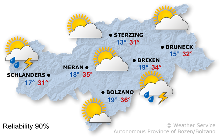
A high-pressure system, combined with subtropical air masses, is set to bring another hot summer’s day.
In the afternoon, the sun will cause a few cumulus clouds to form, leading to the odd heat-induced thunderstorm.
Maximum temperatures ranging from 28° to 36°.
Sunshine and a few thunderstorms
On Wednesday morning, it will be mainly sunny, whilst isolated thunderstorms are possible again in the afternoon.
On Thursday, sunny spells will continue, but there is a higher likelihood of afternoon thunderstorms.
On Friday, the weather will be changeable, with sunshine, clouds and a few thunderstorms. Temperatures will fall slightly.
On Saturday, the weather will be fairly good, with sunshine and a few localised showers.
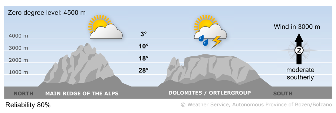
A high-pressure system, combined with subtropical air masses, is set to bring another hot summer’s day.